What makes land around Charlotte developable
Five site checks help determine what you can build, what approvals you need and whether the economics work.
The short version
- Sewer and water service are among the first feasibility checks for townhome and multifamily sites, and the details matter more than whether a line exists on a map.
- Zoning is a legal starting point, not a final answer: a parcel with suitable zoning can still be expensive to develop, and a parcel needing rezoning still carries approval risk.
- Watershed rules set a maximum built-upon area for a site. That constrains the layout; it doesn't hand you a unit count by itself.
- Deed acreage isn't buildable acreage. There's no reliable percentage to subtract from every tract; it takes a constraints plan.
- Road frontage has to translate into an approvable entrance, and that depends on NCDOT sight-distance and access standards, not just having road access.
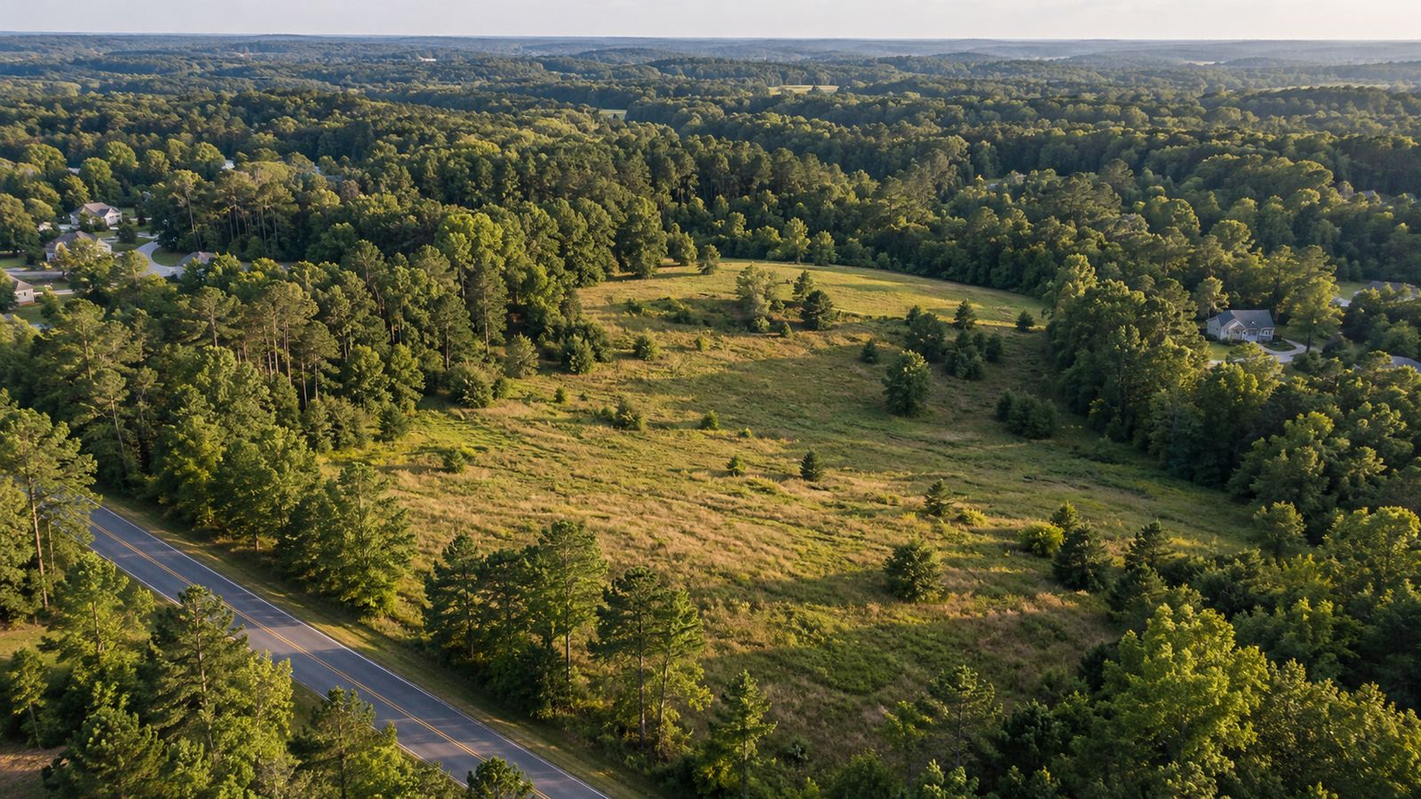
A landowner looking at an eight-acre tract sees acreage, road frontage and a location. A developer also needs to understand the utilities, approval requirements and site work needed to turn that land into a finished project.
Those details can produce very different outcomes for otherwise similar properties. At SPR Construction, we start with five checks: sewer and water service, zoning, watershed and stormwater requirements, usable terrain, and access. We then test the likely development cost against what the finished homes can support.
Development potential also depends on the proposed use. Land that cannot economically support townhomes may still work for a smaller residential project.
Sewer and water service
A line on a map is a starting point, not an answer.
For townhome and multifamily sites, public sewer is one of the first feasibility checks. A line on a map is a starting point. We need to understand the connection location, elevation, downstream capacity, extension requirements and any off-site easements needed to reach it.
Charlotte Water distinguishes between a Preliminary CAP Review and full Capacity Assurance Program approval. The preliminary review helps identify capacity issues but does not reserve capacity. Full CAP approval reserves capacity for two years, subject to the program requirements. Neither should be mistaken for confirmation that all necessary connecting infrastructure is already in place.
If gravity service is impractical, ask the utility and civil engineer which alternatives are acceptable. A pump station or other engineered solution can change the project cost and operating obligations. Do not assume the utility will take ownership; public acceptance follows an approval and dedication process.
Water service deserves an early check as well, including the proposed domestic demand and fire-protection needs.
Conventional septic can constrain density. Mecklenburg County evaluates soils and site conditions before approving a system. Engineered wastewater alternatives may be possible, but their permitting, land requirements, cost and ongoing operation need separate evaluation, and the NC DEQ Non-Discharge Branch is the state authority for those. The absence of public sewer calls for a different feasibility analysis, not an automatic disqualification.
Zoning and the approval path
The legal starting point, not the final answer.
Current zoning establishes the legal starting point. Check the permitted uses, dimensional standards, applicable overlays and any conditions attached to an earlier rezoning. Recorded restrictions also belong in the review.
If the proposed use requires a rezoning, assess its consistency with adopted plans, surrounding development and infrastructure. Approval is discretionary. Charlotte's rezoning process includes staff review, public participation and a City Council decision; revisions and deferrals can affect the schedule. Use a project-specific timeline instead of assuming every rezoning takes the same number of months. (We wrote more on that timeline in how long rezoning actually takes in Mecklenburg County.)
A parcel with suitable zoning can still be expensive to develop. A parcel needing rezoning carries approval risk even when its utilities look favorable. Both issues belong in the price and schedule assumptions.
Watershed and stormwater requirements
A coverage limit, not a unit count.
Confirm the parcel's jurisdiction, watershed district and subarea before applying a coverage limit. Charlotte's rules do not apply uniformly throughout the surrounding metro.
Built-upon area, or BUA, generally includes roofs, pavement and other qualifying impervious or partly impervious surfaces. A BUA limit constrains site coverage; it does not independently establish a unit count. Building footprints, streets, parking, buffers and the applicable development option all affect the resulting layout.
For Charlotte's Lake Wylie Watershed protected area, the UDO provides the following standards. The high-density option requires the applicable permit and stormwater controls.
| Development option | Maximum BUA | Minimum water quality buffer |
|---|---|---|
| Low density | 24% | 40 feet |
| High density | 70% | 100 feet |
Source: Charlotte UDO Article 23, Water Supply Watershed Protection, Tables 23-2 and 23-5 and Section 23.7. These are protected-area standards, not universal watershed rules. Other applicable requirements can further constrain development. Confirm the parcel's classification, qualifying water features and any existing-development treatment before using these figures.
The practical question is which compliant layout works economically after accounting for drainage facilities and their maintenance.
Usable terrain and site work
Deed acreage describes ownership, not what you can build on.
Deed acreage describes ownership. It does not tell you how much land can support buildings and infrastructure at a workable cost. A survey and constraints plan should bring together streams, wetlands, floodplain, easements, tree requirements, stormwater facilities and grading limits.
There is no reliable percentage to subtract from every Charlotte-area tract. Map the constraints together, account for overlaps and test a layout. Otherwise, an acreage estimate can either exaggerate the usable area or subtract the same constrained land twice.
Topography matters because roads, buildings and drainage must work together. A layout that looks efficient on a flat map may require substantial retaining walls, imported fill or exported soil. Geotechnical investigation, guided by Charlotte Water's development design standards, helps identify subsurface conditions that affect the budget; it does not eliminate every unknown.
Worked example
For a project such as our planned 23-unit Lemongrass Townes development on Mount Holly-Huntersville Road, the useful question is which layout balances homes, grading, drainage and infrastructure cost. Additional units add value only when their added revenue justifies the cost and risk of delivering them.
Access and frontage improvements
Frontage is not the same as an approvable entrance.
Road frontage needs to translate into an approvable entrance. For development access to a state-maintained road, involve NCDOT early. Sight distance, driveway placement, traffic movements and required improvements can affect access approval and cost, under NCDOT's policy on street and driveway access. An existing driveway may need changes for a different use.
Identify any additional local review and frontage obligations, including sidewalks, drainage or street improvements. If access crosses another property, have the recorded easement reviewed for the intended development. Confirming legal access and designing a workable entrance are both part of diligence.
How to sequence diligence
Begin with the checks most likely to change the decision to proceed. A basic concept layout and early agency feedback can develop together; Charlotte Water accepts a conceptual plan for preliminary capacity review. Commission more detailed work as the site's risks become clearer.
| Stage | Main purpose |
|---|---|
| Initial screening | Review jurisdiction, zoning, deed and plat history, mapped constraints, utilities and likely access. |
| Early feasibility | Test a basic layout and discuss utility service, access and major site constraints with the appropriate reviewers. |
| Targeted investigations | Obtain surveys and the environmental, soil or geotechnical work needed to address the parcel's risks. |
| Refined feasibility | Update achievable yield, site-work costs, approval schedule, contingencies and project economics. |
The purpose is to resolve meaningful uncertainties before committing to a land price and development budget.
What to gather if you own land
Start with the parcel number or address, recorded deed, latest plat, available surveys, and recorded access or utility easements. Add any prior approvals, environmental reports and utility correspondence you already have. This gives a developer a useful basis for an initial assessment and helps identify the next questions.
An initial review can identify potential and obvious obstacles. Confirming a development program takes further diligence. An appraisal can serve a separate valuation purpose when one is needed.
Common questions
Can land be developed without public sewer?
Sometimes. Suitability depends on the proposed use, soils, available area, permitted wastewater solution and cost. A site that works for a small number of homes may not support the density needed for a townhome project.
Does rezoning guarantee a project can be built?
No. The project must also satisfy the applicable site, infrastructure and permitting requirements and work economically.
How much of my tract is buildable?
That requires a site-specific review. Acreage, zoning and online maps help with screening, but a constraints plan and preliminary layout provide a more useful estimate.
Sources
Official guidance reviewed on 16 September 2026.
- Charlotte Water, Capacity Assurance Program
- Charlotte Water, Donated Projects (Land Development)
- Mecklenburg County, Basic Steps for a New Septic System
- North Carolina DEQ, Non-Discharge Branch
- City of Charlotte, Rezoning Application Instruction Packet
- Charlotte UDO, Article 23, Water Supply Watershed Protection
- NCDOT, Policy on Street and Driveway Access
- Charlotte Water, Development Design Manual
Have a tract in the Charlotte metro?
SPR Construction develops attainable townhomes and workforce housing across the greater Charlotte metro. Send us the parcel address or tax ID and any documents you have. We can discuss the property's potential and the questions that need further investigation.
Or call (704) 774-5148. SPR Construction LLC, Waxhaw, NC. NC General Contractor License 76483 (Building).
This article provides general information about site evaluation. Confirm current requirements with the applicable jurisdiction, utility and project professionals. SPR Construction LLC is a licensed general contractor and developer and does not provide brokerage or appraisal services.
Last reviewed: 16 September 2026.